April 3, 2020. Free access to the AGROasesor platform for crop monitoring through satellite images
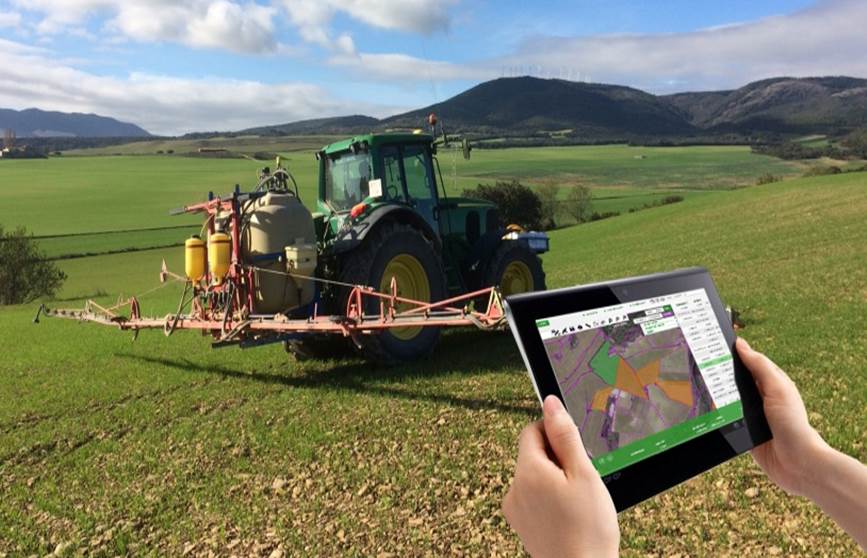
April 3, 2020.– In the special crisis situation caused by COVID 19, this platform is an important working tool that allows to partially monitor crops from a computer.
To freely access the platform, it is necessary to enter this website and identify yourself with the user: PyrenEOS and the password: demo1. In this link you can see a video demonstrating how to access and interpret satellite images.
This tool allows each farmer to manage the information of the actions carried out on his farm and digitally incorporate it into each of his agricultural plots. In this way, the phytosanitary and fertilizer administrative notebooks are kept up to date, since all the information on sigpac enclosures is incorporated, which are updated each campaign automatically.
In addition, this platform enables users to access digital information from soil maps or the aforementioned satellite images, which can be incorporated into the monitoring of their crops. AGROasesor also has very powerful decision support tools, especially in irrigation and fertilization, that carry out daily balances of the needs of nutrients and water in each plot.
This innovative live tool, in constant development, and the personalized technical advice of the INTIA team, constitute a tandem of great value for professionals in Navarre agriculture.
It was launched in 2015, as a result of the collaboration of public entities from five autonomous communities (Navarra, Andalusia, Catalonia, the Basque Country and Castilla La Mancha), coordinated by INTIA, within the framework of a LIFE project whose objective was to tackle new digital advisory systems in crop management.
Currently, it is growing in functionalities, thanks to other European projects such as AGROgestor, PyrenEOS and Nadapta. In Navarra, about 150 people already access the platform with their own username and password. In addition, it plans to expand its scope of action to four other autonomous communities, which are currently developing pilot programs within the framework of the Life AGROgestor project itself, coordinated by INTIA.
These research projects in which INTIA participates are developed within the framework of the Agreement between the Department of Rural Development and the Environment and INTIA, S.A. for the promotion of R + D + i in the agricultural field.
Features
AGROasesor is the first web application at the national level that has managed to integrate the following functionalities, in an agile and accessible web environment: professional advice for each agricultural plot through decision support tools: fertilization, irrigation, diseases, varieties and indicators environmental; logbook and reports; and technical-economic management of farms.
In addition, it offers integration of knowledge (soils, climate, remote sensing, etc.); geolocation and GIS viewer of farms; modeling of the phenological cycle of crops in each plot; calculation of sustainability indicators (water footprint, carbon footprint) of the farm or each agricultural plot; and access to satellite images and tools for crop analysis using remote sensing.


Leave a Reply